Sans Souci Catchment
The Sans Souci catchment is 3.1km2 and is bound by Botany Bay in the east and Rocky Point Road in the west.
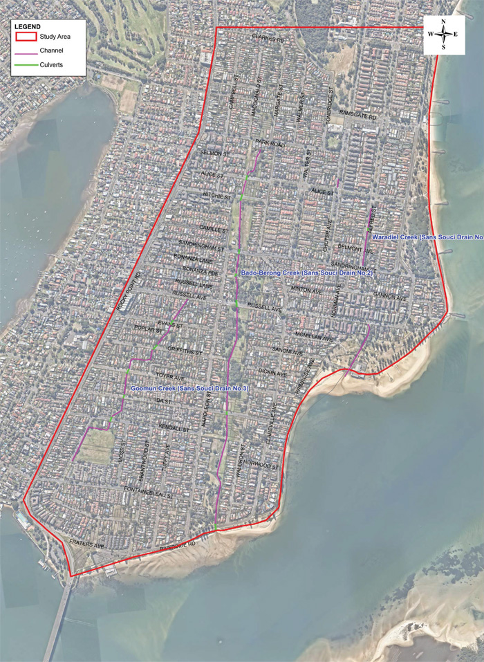
Sans Souci Catchment
The Sans Souci catchment is 3.1km2 and is bound by Botany Bay in the east and Rocky Point Road in the west. Ramsgate Road borders the catchment in the north and includes the uppermost part of the Scarborough Ponds. The catchment is drained by Waradiel Creek, Bado-Berong Creek and Goomun Creek that all flow into Botany Bay.
Land use within the catchment is dominated by low and medium density residential properties with commercial areas along Rocky Point Road and Russell Avenue. Several parks and reserves are located within the catchment and are mostly located along to the three creeks.
A flood study of the catchment was completed in 2015 by Cardno and subsequently supported by the NSW and Commonwealth Governments with funding under the Natural Disaster Resilience Programme. WMAWATER is currently undertaking a review of the Floodplain Risk Management Study for the catchment and a draft report will be publicly exhibited in early 2022.
Volume 2 Flood Study (38Mb)
Managing Flood Risk
Do you live in an area at risk of flooding? Flood extent map, hazard layers and flood affected property information are available in Council’s online mapping system. The NSW State Emergency Service has information that can help you before, during and after a flood.
Prepare Your Home and Business