Image
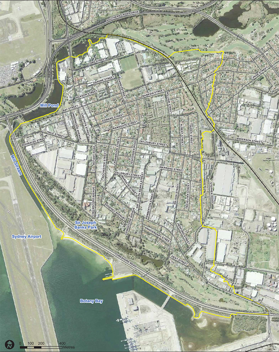
The Botany Bay and Foreshore Beach catchment is approximately 3.5km2. The eastern side of the catchment drains to Sir Joseph Banks Park and the western side drains to the Mill Stream, before discharging to Botany Bay. The topography of the catchment is generally flat with the exception of a low ridge along the eastern boundary. Development in the catchment is comprised of high density residential, commercial and industrial buildings.
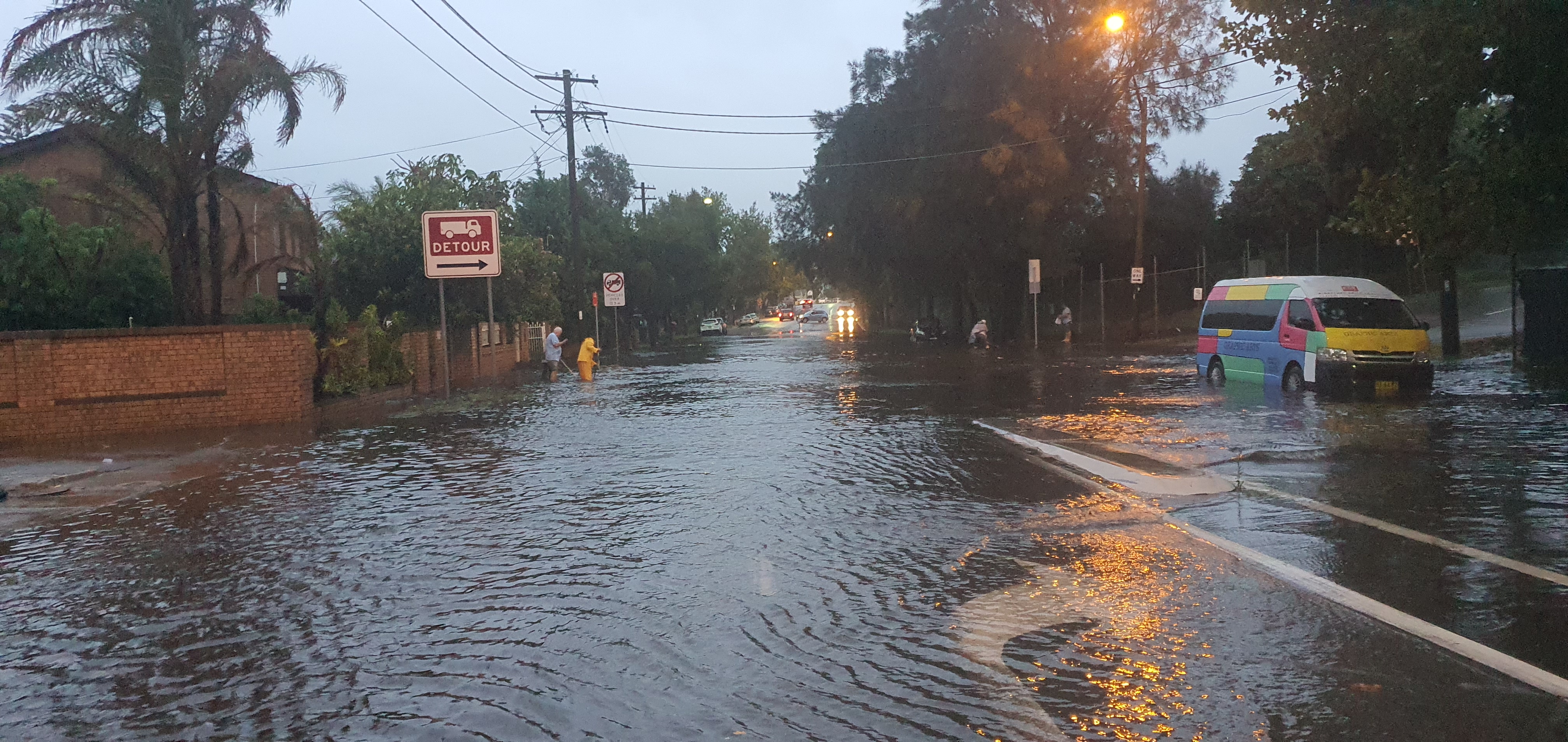
Flooding in the catchment occurs as a result of runoff, during rainfall events, pooling in low lying areas due to a constrained stormwater system. The slow drainage is exacerbated when high tides or storm surges in Botany Bay, coincide with rainfall events. The general flatness of the catchment also means that some areas of the catchment are susceptible to tidal inundation even during dry weather. This areas are at higher risk during spring tides, storm surges and from future sea level rise.
BMT WBM has completed the Botany Bay Foreshore Beach flood study for this catchment in 2015 to analyse the risk of flooding.
Council engaged Jacobs Pty Ltd to undertake a Floodplain Risk Management Study in 2018 to investigate how Council can reduce the flood risk. The study was supported by the NSW and Commonwealth Government with funding under the Natural Disaster Resilience Programme.
The draft study was publicly exhibited in October 2020 and the final draft of the Floodplain Risk Management Study was completed in November 2020.
In December 2020, Council’s Floodplain Risk Management Committee reviewed the final draft of the study and recommended the adoption of the Botany Bay and Foreshore Beach Floodplain Risk Management Study and Plan, incorporating the feedback from public consultation. See the three-part risk management study below.
A range of structural and non-structural flood mitigation options for the study area were assessed for suitability including:
Property modification measures
A number of amendments to planning instruments and controls, including the Local Environmental Plan and Development Control Plan were investigated and recommended.
Response modification measures
This includes recommendations regarding flood depth signage on roads, updates to emergency management plans and procedures, flood education and awareness programs and site specific flood plans.
Flood modification measures.
These cover structural options for reducing the risk of flooding. Nineteen options were investigated and three were recommended for further feasibility studies:
We encourage you to learn more about living in an area with a risk of flooding. The NSW State Emergency Service provides information that can help you before, during and after a flood.
Prepare Your Home and Business, Be Aware