Image

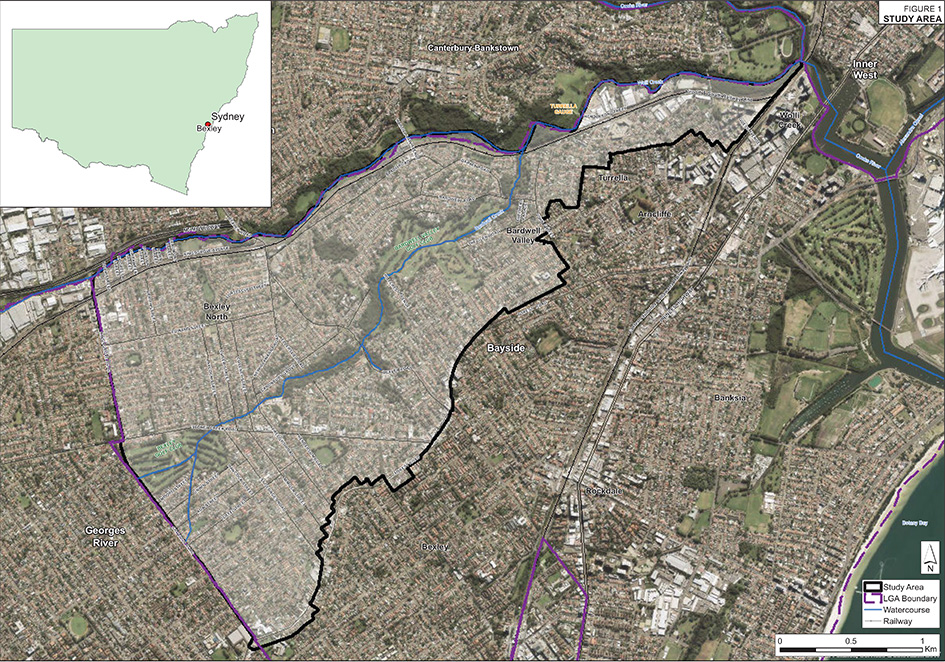
The Bardwell Creek overland flood study area includes the suburbs of Bexley North, Bardwell Park, Bardwell Valley and Turrella, as well as parts of Kingsgrove, Bexley, Arncliffe and Wolli Creek.
Bardwell Creek is a tributary of Wolli Creek. Wolli Creek is in turn a tributary of the Cooks River with its confluence at the Tempe railway bridge crossing the Cooks River.
The study area contains the portion of Bardwell Creek and Wolli Creek within Bayside Council LGA and covers an area of approximately 713 hectares (7.1 km2). The upper catchment includes parts of Hurstville, Penshurst, Beverly Hills and Narwee within the Georges River LGA. The northern side of Wolli Creek includes parts of the suburbs of Roselands and Earlwood within the Canterbury Bankstown LGA.
WMAWater completed the Bardwell Creek Flood Study in 2018. The study was subsequently supported by the NSW and Commonwealth Governments and was adopted by Council in April 2019. WMAWATER is currently undertaking a review of the Floodplain Risk Management Study for the catchment and a draft report of the study will be publicly exhibited in early 2022.
Bardwell Creek Flood Study Volume 1
Bardwell Creek Flood Study Volume 2
Do you live in an area at risk of flooding? Flood extent map, hazard layers and flood affected property information are available in Council’s online mapping system. The NSW State Emergency Service has information that can help you before, during and after a flood.
Prepare Your Home and Business, Be Aware